THE DEVELOPMENT OFF EAGRY now known as EAGRY GARDENS
E/2001/0247/F and E/2001/0248/F Eagry Gardens Bushmills
FLOODING - A PHOTO ALBUM
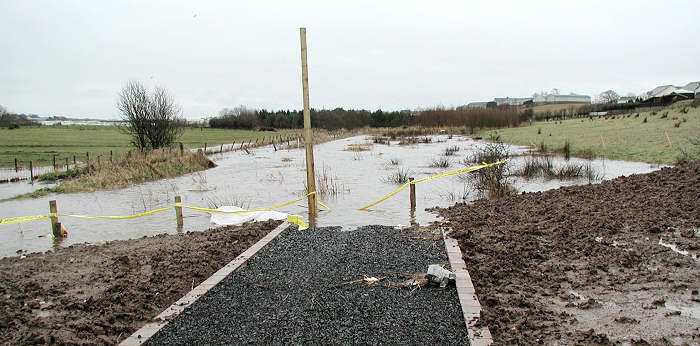
On 12th March 2006, after torrential overnight rain, St Columb's Rill, which forms the eastern boundary of these two building sites, burst its banks once again.

Page Five
Click to see this photo with  location details superimposed
Looking from the lower path of the newly built Open Space public play area into the (yet to be developed) site 0247. The flood plain in this picture is scheduled to be filled in and a road built on top. Several of the houses destined to be built here will encroach into this 'built up' flood plain area. The usual route of St Columb's Rill can be seen between the two sets of fence posts on the left.
<< Return to first page of these flooding photos
CLICK PHOTO TO SEE LOCATION DETAILS
<< Return to list of Flooding documents on this web site
<< Return to main Eagry Home page
On to final page of March 2006 flood photos>>